Here's part 2 of 4 on trail tech. The first was on tracking devices. This one will be on the philosophy of smartphone use on the trail. The third will be practical considerations of smartphone use and the final installment will be on keeping all these gadgets charged.
There's no doubt that smartphones have changed the way we live our lives. We now have more computing power in our pocket than they used to send men to the moon. (Several times over.) Apps are available for just about anything you can imagine and the ability to connect to networks lets users communicate as never before.
Smartphone use definitely changes the trail experience. Whether that change is for the better or worse is a "religious argument" akin to abortion and gun control in that everybody has an opinion which is very unlikely to change, but that doesn't stop anyone from trying to sway everyone else.
On the positive side, the GPS built into smartphones allows you to know exactly where you are on the planet at any given point in time. This is a big safety advantage as well as a navigational convenience. You can now bring your entire music library with you as well as books (textual and audio) and even movies if you have enough memory. The previously mentioned network capability allows texting, blogging and phone calls on up to 60-70% of the PCT according to some estimates. There are compass apps, calculators, clocks and alarms, etc, etc, etc.
On the negative side, the argument generally goes that all of this connectivity, safety and entertainment waters down the wilderness experience. Standing in a beautiful meadow or on an otherwise remote peak then taking a selfie to text to friends, blogging about it and yakking on the phone to the folks back home distracts your from fully appreciating the experience, makes the wilderness less wild and the moment less extraordinary. We are surrounded by a million things beeping at us and demanding our attention at home, do we really need them here; in the wilderness?
Luckily, we CAN have it both ways. I would argue that 95% of technology users forget that their devices have an "off" switch. Once we get a new device and start using it, it's very easy to become a slave to it. But it doesn't have to be that way. It's really simple; if you don't need it, TURN IT OFF. This simple philosophy allows you to choose your own wilderness experience.
So I fall on the side of bringing the phone along, learning how to use it to the best advantage on the trail, then turning it off except when it's really needed. This not only preserves the wilderness experience, but also your batteries, which is a real consideration on the trail.
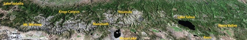
The Sierra Nevada
Thursday, April 16, 2015
Wednesday, April 15, 2015
They're on the way
Melinda and Liz have just finished their first night on the trail, "cowboy camping" for the first time.
There was little confusion in finding the trailhead resulting in Border Patrol responses and a dirty Lexus. (See their blog for details.)
For my part, I was frantically texting pictures of the trailhead monument found on the internet to help them find their way. I have no idea if it helped, but they did get there and set off on time.
I then wondered if they would turn on their tracker and was relieved to see the blue dots show up on my computer. The novelty is already starting to wear off and I find I'm able to focus on work better today.
They were able to text and post to the blog both before the start and at day's end. I don't expect that to continue, but it was nice to be able to communicate as they set off.
Bodie and I are adjusting. We have listed chores on the blackboard and who should be be doing them. We will see how that works out. We definitely need to find a task distribution that works, because I've already found that there just aren't enough hours in the day for me to do my job and Melinda's by myself. Bodie is trying to do his part, hopefully that will continue as the weeks go on.
Day 2 has begun and the ladies are approaching Lake Morena and the 20 mile mark. They planned for a slow start to let their bodies acclimate to the extra work they are asking them to perform. The first major milestone is Mount Laguna, where they are due on Friday.
Friday, February 20, 2015
About that trail tech....
Hello again, it's been a while. I've been helping the ladies get set for their trip, including setting up the Liz and Melinda's Excellent Adventure blog.
Their trip is only 2 months away now, and the preparation activities are hitting a fever pitch.
I plan a couple of posts about tech on trail, this is the first, looking at beacons/trackers. these devices are used in a couple of different ways, but probably the driving factor in using one is having emergency response available literally anywhere in the world with the push of a button.
Strictly speaking, a beacon is a specific device transmitting using a specific technology on specific frequencies approved by NOAA search and rescue teams.
There are three types of beacons used to transmit distress signals, EPIRBs (for maritime use), ELTs (for aviation use), and PLBs (used for land-based applications).
These beacons are highly reliable, very narrow in scope, very expensive and use somewhat outdated technology. They use satellite tracking to get within a 2-3 mile radius, then a different radio "beacon" to allow SAR teams to home in on the device. Most don't use GPS, although some newer units do.
Because of the expense and outdated technology, most outdoorsmen and women now use trackers that utilize one of 2 most popular satellite phone networks, Iridium or Globalstar. It turns out that which network is used is one factor in choosing a tracker unit. More on that later.
These trackers typically use GPS to determine their place on the planet, which can be done with great accuracy. (Generally can report accurate coordinates to within 30 feet.) They then send coordinates and an SOS message via a satellite phone network. These units also have the ability to send coordinates on a regular basis so that family and friends can follow along, and some have the ability to send and receive short text messages.
I'm going to focus on the 2 most popular units, the SPOT Gen3 messenger and the DeLorme InReach SE. They have many features and requirements in common, including an SOS button that summons help in an emergency, the ability to send tracking updates to a web site and the need to pay for a subscription to use the service in addition to the purchase price of the unit itself. I'll focus on the advantages of each when compared to the other.
SPOT Gen3 advantages:
Liz and Melinda will be carrying a solar charger (More on that later) so keeping it charged on the trail should not be an issue.
That's it for now, I'll write more later about smartphone use on the trail.
Their trip is only 2 months away now, and the preparation activities are hitting a fever pitch.
I plan a couple of posts about tech on trail, this is the first, looking at beacons/trackers. these devices are used in a couple of different ways, but probably the driving factor in using one is having emergency response available literally anywhere in the world with the push of a button.
Strictly speaking, a beacon is a specific device transmitting using a specific technology on specific frequencies approved by NOAA search and rescue teams.
There are three types of beacons used to transmit distress signals, EPIRBs (for maritime use), ELTs (for aviation use), and PLBs (used for land-based applications).
These beacons are highly reliable, very narrow in scope, very expensive and use somewhat outdated technology. They use satellite tracking to get within a 2-3 mile radius, then a different radio "beacon" to allow SAR teams to home in on the device. Most don't use GPS, although some newer units do.
Because of the expense and outdated technology, most outdoorsmen and women now use trackers that utilize one of 2 most popular satellite phone networks, Iridium or Globalstar. It turns out that which network is used is one factor in choosing a tracker unit. More on that later.
These trackers typically use GPS to determine their place on the planet, which can be done with great accuracy. (Generally can report accurate coordinates to within 30 feet.) They then send coordinates and an SOS message via a satellite phone network. These units also have the ability to send coordinates on a regular basis so that family and friends can follow along, and some have the ability to send and receive short text messages.
I'm going to focus on the 2 most popular units, the SPOT Gen3 messenger and the DeLorme InReach SE. They have many features and requirements in common, including an SOS button that summons help in an emergency, the ability to send tracking updates to a web site and the need to pay for a subscription to use the service in addition to the purchase price of the unit itself. I'll focus on the advantages of each when compared to the other.
SPOT Gen3 advantages:
- Lower entry price. The unit can be found for about $125 as opposed to $299 for the InReach SE. (In all fairness, the InReach seems to always have a $50 rebate program going on.)
- Smaller device, easier to pack.
- Motion activated, will turn itself off if you forget to.
- $99 per year subscription cost (no tracking) or $149 per year with tracking.
- Uses AAA batteries, easy to have spares on hand. (The InReach battery is built in and must be recharged via a USB cable.)
- Can send and receive text messages (Both pre-programmed and free-form)
- Monthly subscriptions available which can be suspended when not in use. This is cheaper in the long run if you only plan to use the device a couple of months per year.
- Can be paired via bluetooth with a smartphone, giving a much improved user interface.
- Uses the Iridium network. Iridium has true global coverage. (Globalstar does not cover the polar regions.) SPOT users have also complained about message and tracking reliability. This is believed to be associated with use of the Globalstar network.)
- Superior tracking web site using DeLorme Topo and street maps. Easy integration with Facebook and Twitter.
- Better customer experience (IMHO) including an easier to use customer web site and more straightforward device setup and maintenance.
Liz and Melinda will be carrying a solar charger (More on that later) so keeping it charged on the trail should not be an issue.
That's it for now, I'll write more later about smartphone use on the trail.
Wednesday, August 27, 2014
Melinda and Bodie do Desolation
Melinda and our son Bodie decided to do a second Tune-up cruise while Liz worked on healing her injured knee. (Maybe Liz will write more about that on the "LMEA" blog.)
Their original plan was to:
Day 2 started out soggy, then cleared, then every time they got motivated to take off, it went soggy again. During one of these respites from the rain, Melinda packed her tent just before the rain started up again. She dove into Bodie's tent, and there they stayed all day... 2 not so small people packed into a single person backpacking tent. Bodie mostly slept (That's what teenage boys do) and Melinda read.
Day 3 dawned brighter, so they decided to head out. They thought that the Rubicon reservoir might be a bit of a stretch given their lost day, so they changed their plans and did the McConnell Lakes loop, which goes by several lovely lakes and returns you to the Rubicon river. This went well, with the exception of a bit of a detour. When they reached the Rubicon River, they somehow ended up on a trail that took them back to the last lake they visited, Four Q's Lake. Once they sorted that out and made it back to the Rubicon, they were losing daylight, son they went south on the Rubicon trail to China Flat and camped there for the night. During the night, there was huge crashing sound that Melinda was sure was a bear climbing a tree to get their food. The next morning though, their food was untouched. They did find a tree that had very recently been gnawed through by a beaver, so they think the falling tree is what made the racket.
On day 4, they got up and headed out on the Rockbound trail without further incident.
Altogether, it was a very successful trip in spite of the blisters Melinda got from her new "Guaranteed blisterproof" boots.
 |
| Bodie and Melinda's track on the left. Part of Liz and Melinda on the right. |
Their original plan was to:
- Enter at Wrights lake and go to Lake Schmidell via the Red Peak Stock trail the first day
- Go to the Rubicon Reservior on day 2.
- Take the Rubicon trail to Doris Lake on day 3.
- Exit via Rock Bound pass on day 4.
Day 2 started out soggy, then cleared, then every time they got motivated to take off, it went soggy again. During one of these respites from the rain, Melinda packed her tent just before the rain started up again. She dove into Bodie's tent, and there they stayed all day... 2 not so small people packed into a single person backpacking tent. Bodie mostly slept (That's what teenage boys do) and Melinda read.
Day 3 dawned brighter, so they decided to head out. They thought that the Rubicon reservoir might be a bit of a stretch given their lost day, so they changed their plans and did the McConnell Lakes loop, which goes by several lovely lakes and returns you to the Rubicon river. This went well, with the exception of a bit of a detour. When they reached the Rubicon River, they somehow ended up on a trail that took them back to the last lake they visited, Four Q's Lake. Once they sorted that out and made it back to the Rubicon, they were losing daylight, son they went south on the Rubicon trail to China Flat and camped there for the night. During the night, there was huge crashing sound that Melinda was sure was a bear climbing a tree to get their food. The next morning though, their food was untouched. They did find a tree that had very recently been gnawed through by a beaver, so they think the falling tree is what made the racket.
On day 4, they got up and headed out on the Rockbound trail without further incident.
Altogether, it was a very successful trip in spite of the blisters Melinda got from her new "Guaranteed blisterproof" boots.
Wednesday, July 9, 2014
The first training trip

The ladies decided to do a training trip on the PCT (their first) over the 4th of July weekend.
They had hoped to cover the distance from Highway 50 at Echo Lake (near South Lake Tahoe) to Donner lake, on Highway 80. The total distance is about 60 miles, requiring a pace of 20 miles per day, about what they need to average next year. They came up well short and I'll let them say their own bit, but here are my guesses as to why:
- Altitude. They left sea level at about 9:00 AM in an exhausting 5.25 hour drive up to 5,000 feet where they slept on my sister's hard deck before heading out the next morning. So with about 18 hours at about 5000 feet, they drove up to Echo Lake at 7,500 feet and climbed to 9000 feet the same day. I've heard recommendations of 3 days to 2 weeks to adjust to exercise at altitude, and they clearly didn't have that. This likely led to their limited energy and sense of "getting their butt kicked" on that first day of 13 miles. This obviously won't be an issue on the "real" hike. They start in the desert and gradually climb over time.
- Heat. Even at altitude, it was hot over the weekend. It was easily in the 80s and much of their walk was over exposed solid granite, which reflects light but absorbs and re-releases heat. They were above the tree line for much of the hike, so there wasn't a lot of shade to be had. It was hot!
- Dog. They took our hound along for the trip. While the ladies are hesitant to blame the dog for not making their goal, I'm sure he slowed them a bit and he was clearly shot by the end of the day.
- Training. They have been walking wherever they can, but neither of them has done more than about 15 miles or so in a single stretch at sea level. 20 miles per day for 3 consecutive days was quite ambitious.
- Terrain. Looking at the entire section of the PCT, they climbed from a low point to very nearly the highest point in a single day. Once they crossed Dicks pass, it would have been pretty much downhill or level (with some up and down of course) for the rest of the 60 miles. But by the time they stopped, they were shot.
I think they learned a lot, everyone (including the dog) has recovered and most importantly; their spirit is unbroken.
Thursday, July 3, 2014
Tech on the trail - how much is enough and how much is too much?
I'm an engineer.
If you know or love one, that's probably enough said. :-)
If not, suffice it to say I love electronic gadgets and can't get enough. My wife? Not so much... Therefore, I'm taking on the role of tech adviser for Liz and Melinda's excellent adventure.
We've come a long way from the time when being in the wilderness meant being cut off from civilization. Walkie Talkies, Handheld HAM radios, cell phones plus satellite communicators and phones are all available to help you stay in touch. But people who enjoy through hiking don't generally do it as a social exercise. It's about being self sufficient, strong, smart and resourceful enough to persevere through months on the trail. People who are good at that tend to be individualists and nature lovers who probably don't want a magnificent sunset vista on a remote mountaintop ruined by a squawking "you've got mail!" alert from some electronic device.
Some also say that use of tech on the trail might lead folks to make unwise decisions, fording a torrent or crossing a slippery slope that they might otherwise avoid if they didn't have a helicopter on speed dial. The trouble with relying on a rescue is that if there's a cliff at the bottom of that slope, the helicopter will only be able to pick up the pieces.
However, I think most people who would even consider a trip like this have the outdoor skills and good judgment to use tech appropriately. And the peace of mind that it can give participants and their families can't be underestimated.
After a lot of research, I suggested that L & M each take a smart phone and together take one satellite communicator. Of course these gadgets need juice, so an efficient solar charger with a USB connector is also required.
Stay tuned for future posts about my current thinking on the right devices and how I decided on them.
What's this all about?
My wife Melinda and good friend Liz are off on an adventure.
They plan to hike the entire length of the Pacific Crest Trail (PCT), Mexico to Canada, 2,660 miles, between April and September of 2015.
Yes; they are nuts.
I started this blog as a way to practice for setting up thier blog, which is linked on the right.
I hope to keep at it, chronicling what's it's like to help them get prepared, send them off, and switch to single parenthood (We have a 16 year old son) for 4-5 months.
Stay tuned for more....
Subscribe to:
Posts (Atom)